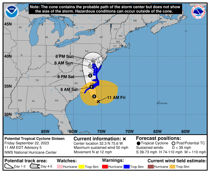
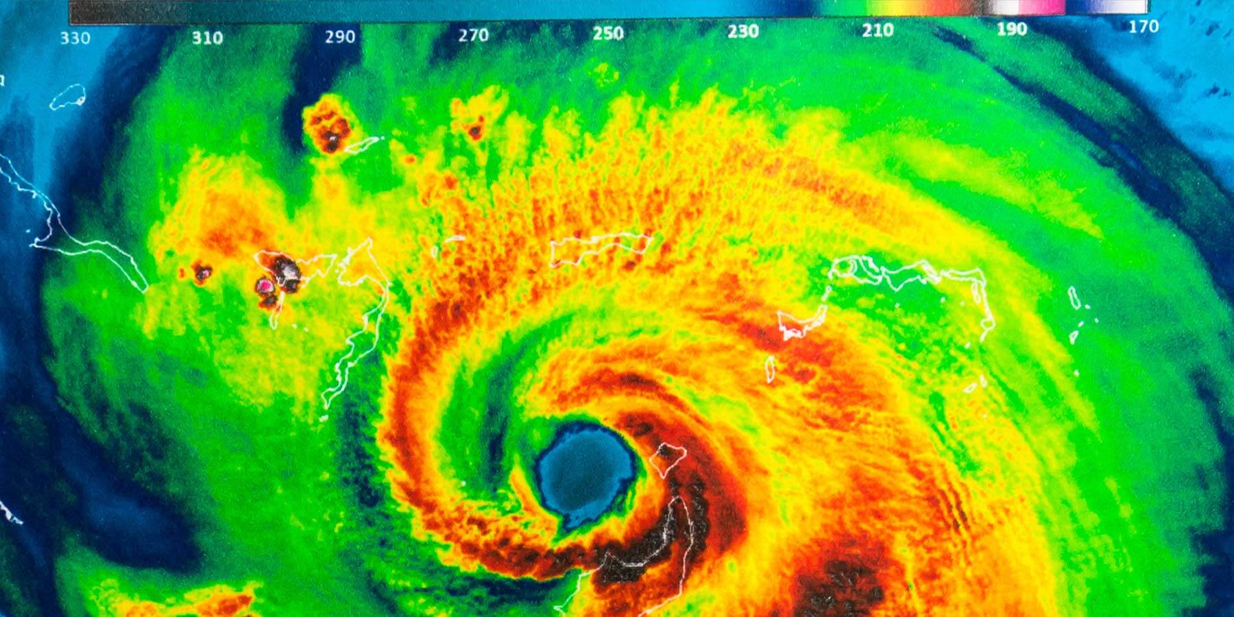
On September 22, 2023, Tropical Cyclone Sixteen gained strength and was officially named Tropical Storm Ophelia, boasting sustained winds of 70 mph. This formidable storm aimed its center at North Carolina, making landfall by the morning of September 23, 2023. At the time, its path was predicted to sweep across eastern North Carolina, southeast Virginia, and the Delmarva Peninsula, accompanied by heavy rains up to 5 inches and storm surges reaching 6 feet.
The National Hurricane Center (NHC) issued hurricane watches along the North Carolina coast, from north of Surf City to Ocracoke Inlet, with warnings that Ophelia might escalate to a Category 1 hurricane if sustained winds exceeded 74 mph.
The History of Hurricanes and Tropical Storms Named Ophelia
The name Ophelia has been historically assigned to four storms, with the most recent one in 2023. Previous notable storms include:
Hurricane Ophelia, 2005
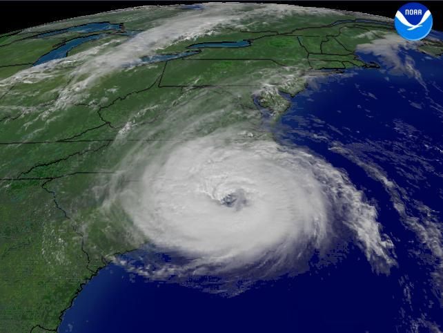
Originating from Tropical Depression #16, Ophelia formed on September 6, 2005, near Florida. By the following day, it intensified into a tropical storm and quickly developed into a hurricane. It reached its peak intensity as a Category 1 hurricane, bringing heavy rainfall and strong winds to Florida.
Ophelia ultimately made landfall on the eastern coast, causing significant disruptions, power outages, and damage to infrastructure, while also contributing to the seasonal rainfall totals in the region.
Hurricane Ophelia, 2011
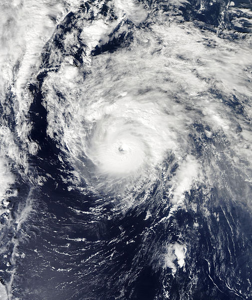
This iteration of Hurricane Ophelia developed from a tropical wave that interacted with the Intertropical Convergence Zone (ITCZ), a critical area where trade winds meet, creating conditions conducive to storm development. The system slowly organized, and by September 20, 2011, it was classified as a tropical depression. Ophelia strengthened into a tropical storm on September 21 and hit its first peak intensity of 55 knots by September 22.
As it progressed and moved westward, Ophelia briefly weakened but regained strength and became a hurricane by September 29. Hurricane Ophelia peaked at 120 knots as a Category 4 hurricane on October 2 just off Bermuda and weakened rapidly after, losing its tropical characteristics before making landfall in Newfoundland on October 3.
Hurricane Ophelia, 2017
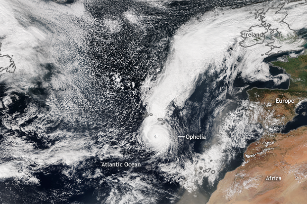
This storm captured attention not for its sheer strength but for its unusual trajectory. Formed in the eastern Atlantic, Ophelia gained strength over moderately warm waters and eventually reached Category 3 status. What made Ophelia particularly noteworthy was its path, which took it abnormally far north and east, ultimately impacting Ireland as a post-tropical cyclone.
It made landfall on October 16, 2017, bringing severe winds and heavy rain, causing widespread power outages and damage. The storm’s behavior raised discussions among meteorologists regarding the influence of climate change on hurricane patterns and trajectories.
Tropical Storm Ophelia, 2023
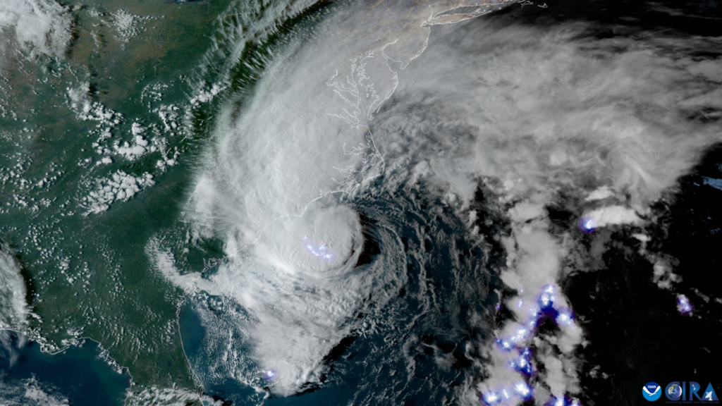
Tropical Cyclone Sixteen formed on September 21, 2023, when a low-pressure area developed off the Southeast US coast. By September 22, it had strengthened into the 15th named storm of the 2023 Atlantic Hurricane Season. Tropical Storm Ophelia made landfall near Emerald Isle, NC, early on September 23, bringing heavy rainfall, gusty winds, and significant flooding to Eastern North Carolina.
Although it caused widespread impacts, there were no fatalities or injuries reported.
Impacts from Tropical Storm Ophelia 2023
As noted above, Tropical Cyclone Sixteen did reach tropical storm status, taking the name Tropical Storm Ophelia for the 2023 Atlantic Hurricane Season. Below were its impacts:
- Rainfall: Tropical Storm Ophelia delivered substantial rainfall across the southeastern United States. Bands of rain, embedded with occasional squalls and thunderstorms, began affecting coastal areas on late Friday, September 22 and persisted through much of Saturday, September 23. The heaviest rainfall occurred along the I-95 corridor from Emporia, VA to the Richmond Metro Area, where rates reached 0.5-1.5 inches per hour. Some locations reported total accumulations of 3-4 inches of rain, leading to road closures due to flooding.
- Storm Surge: Ophelia caused moderate to major tidal flooding from Friday night, September 22, through Saturday evening, September 23. Water levels in some parts of the lower bay and lower James River rose to +3 feet Mean Higher High Water (MHHW) or more. Jamestown experienced its highest water levels since 2016, which temporarily disrupted ferry services. Tidal flooding extended up the James River as far as Hopewell.
- Tornado Threats: The storm system also spawned a brief EF-0 tornado in Belvidere, NC, located in northern Perquimans County, on the morning of September 23. The tornado’s impact was limited but exemplified the severe weather potential associated with the storm.
- Storm Trajectory: Initially labeled “Potential Tropical Cyclone Sixteen,” Tropical Storm Ophelia formed southeast of Wilmington, NC, and moved northward. It made landfall in Emerald Island, NC, early on September 23 with winds of 70 mph. Northeast winds gusted at up to 50-65 mph near the VA/NC coast prior to landfall, with inland gusts reaching 25-45 mph. The storm weakened as it tracked north along I-95, becoming a depression by the time it reached the Richmond Metro Area. Ophelia transitioned into a post-tropical cyclone before exiting to the north/northeast on Sunday, September 24.
Revisiting Tropical Storms and Hurricanes Named Ophelia
The various transformations of storms named Ophelia highlight the unpredictable nature of tropical storms and the ongoing necessity for preparedness and resilience. Their effects remind us to stay vigilant and informed as we approach future storms.
Prepared yourself for tropical storms and hurricanes similar to Ophelia’s various iterations by visiting our Hurricane Resource Center for details and tips on staying safe during storm seasons.
