For tropical storms and hurricanes, a name like Jerry can mean anything. For meteorologists and the general public, it is a reference point, making it easier to track the storm’s impacts.
Jerry joins the 2025 Atlantic hurricane season as the 10th named storm. This guide covers everything you need to know, including Jerry’s formation patterns, vulnerable areas, and preparation tips.
The Name Jerry in Hurricane History
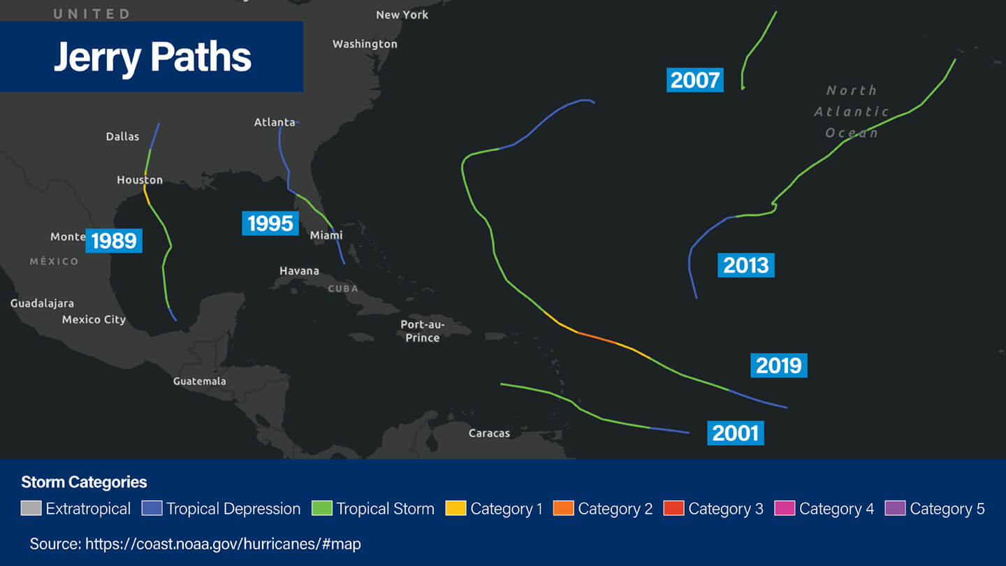
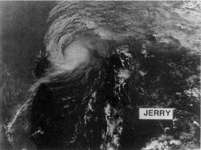
The name Jerry has appeared multiple times in hurricane history. In 2019, Hurricane Jerry developed near the Cape Verde Islands but remained largely at sea, sparing coastal populations from widespread damage.
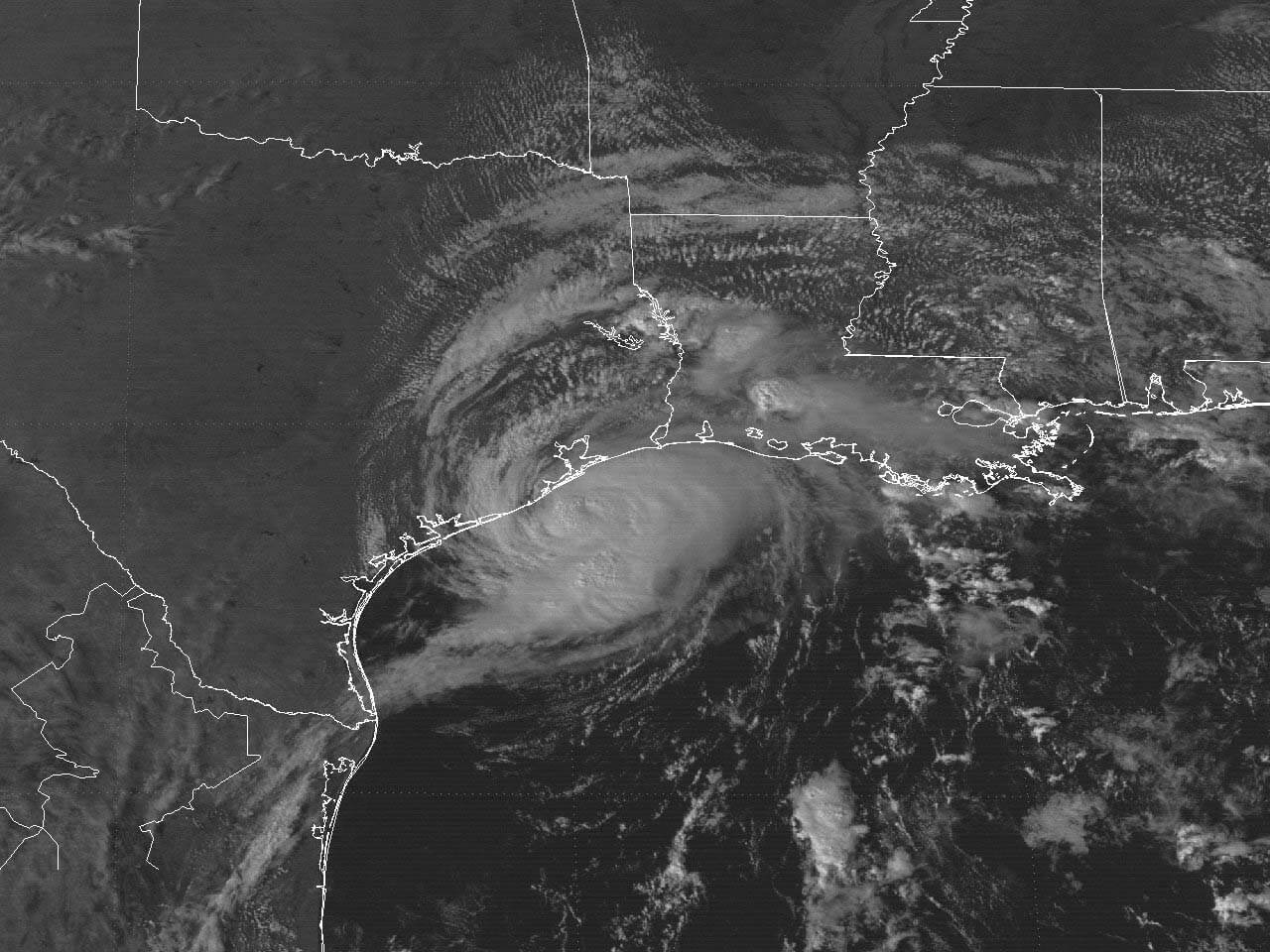
Another Jerry occurrence was in 1995 with Tropical Storm Jerry, which originated in the Gulf Coast and made landfall in Texas, bringing flash flooding and moderate wind damage. Hurricane Jerry in 1989 followed a distinct path, recurving in the Atlantic to avoid major landfalls.
One point worth noting is how storm names are either retired or reused. Names like Katrina and Sandy were taken out of rotation because the storms caused widespread destruction and lasting damage.
In comparison, none of the past storms named Jerry were strong enough or caused enough harm to be removed from the list. When a storm doesn’t leave a major mark, its name stays in circulation, which is why Jerry has appeared more than once in NOAA’s records.
Here’s an overview of major storms sharing the name Jerry:
| Year | Storm Type & Peak Intensity | Landfall/Closest Approach |
|---|---|---|
| 1989 | Hurricane Jerry (Cat 1) | Made landfall on Galveston Island, Texas |
| 1995 | Tropical Storm Jerry | Made landfall on Jupiter, Florida and then crossed the Southeast U.S. |
| 2001 | Tropical Storm Jerry | Passed just south of Barbados (Windward Isles) |
| 2007 | Tropical Storm Jerry | Remained far out in the Atlantic Ocean until it dissipated |
| 2013 | Tropical Storm Jerry | Stayed far east of Bermuda |
| 2019 | Hurricane Jerry (Cat 2) | Passed north of Leeward Islands with no landfall |
Understanding Jerry’s Formation and Development Patterns
To grasp how Jerry, or any storm, forms, we must first understand key meteorological drivers. Tropical storms like Jerry begin as disturbances, often from tropical waves originating near the West African coast. These disturbances thrive in ocean waters that exceed 79.7°F (26.5° C), their heat providing the energy required for storm intensification.
Additionally, weak vertical wind shear allows storm clouds to build vertically, while the Coriolis effect helps circulate air around a low-pressure center, forming the storm’s rotation. When combined with upper-level atmospheric divergence that vents warm air away, these factors create organized systems we recognize as tropical storms and hurricanes.
Rapid intensification is also a key feature to watch in storm development, which is driven by ocean heat content and atmospheric moisture.
What Regions Have Been Impacted By Past Jerry’s?
From densely populated island nations to coastal U.S. communities, understanding which areas are most vulnerable helps inform early preparedness and response efforts.
Below are the primary regions prior storms named Jerry affected.
While Jerry’s path for this year is difficult to predict, the regions below should always be on the lookout as they are particularly susceptible to tropical storms and hurricanes during the peak season.
| Region | Rationale Risk | Historial Context |
|---|---|---|
| Caribbean Islands | Close to storm formation zones in the Atlantic; vulnerable due to size, infrastructure, and population density | 2001 Jerry passed near Barbados; 2019 Jerry passed north of the Leeward Islands |
| Bermuda | Often impacted by recurving storms that stay in the Atlantic | 2013 Jerry remained east of Bermuda; 2019 Jerry passed nearby but offshore |
| Gulf Coast (Texas) | Western-tracking storms often reach the Gulf; high frequency of landfalls | 1989 Jerry made landfall near Galveston; 1995 Jerry impacted the Gulf before moving east |
| Southeastern U.S. | Vulnerable to storms crossing Florida and moving inland or up the coast | 1995 Jerry made landfall in Jupiter, FL, and moved across Georgia and the Carolinas |
Caribbean nations, which often lie in the path of early-stage tropical systems, remain especially vulnerable due to their close proximity to storm origin zones. Bermuda’s location also places it within the crosshairs of recurving storms like previous Jerry systems.
The Gulf Coast and Southeast U.S. coastline, notorious for frequent and sometimes devastating hurricane landfalls, remain regions of heightened focus should Jerry adopt a westerly or northwesterly track.
Meteorological Challenges in Intensity and Tracking
Predicting storm intensity is one of the most complex aspects of modern meteorology. Factors such as dry air, ocean heat content, and wind shear combine to create a challenging forecasting landscape.
For example, dry air pockets from the Saharan Air Layer can weaken storm development, while high wind shear can disorganize storm structure, interfering with intensification.
Despite advances in modeling, meteorologists must rely on ensemble forecasts to weigh different scenarios and potential trajectories.
Advanced observation tools such as hurricane hunter aircraft and satellite technology play an important role in capturing real-time data, providing invaluable insights into storm structure and movement.
Anatomy of Hurricane Jerry
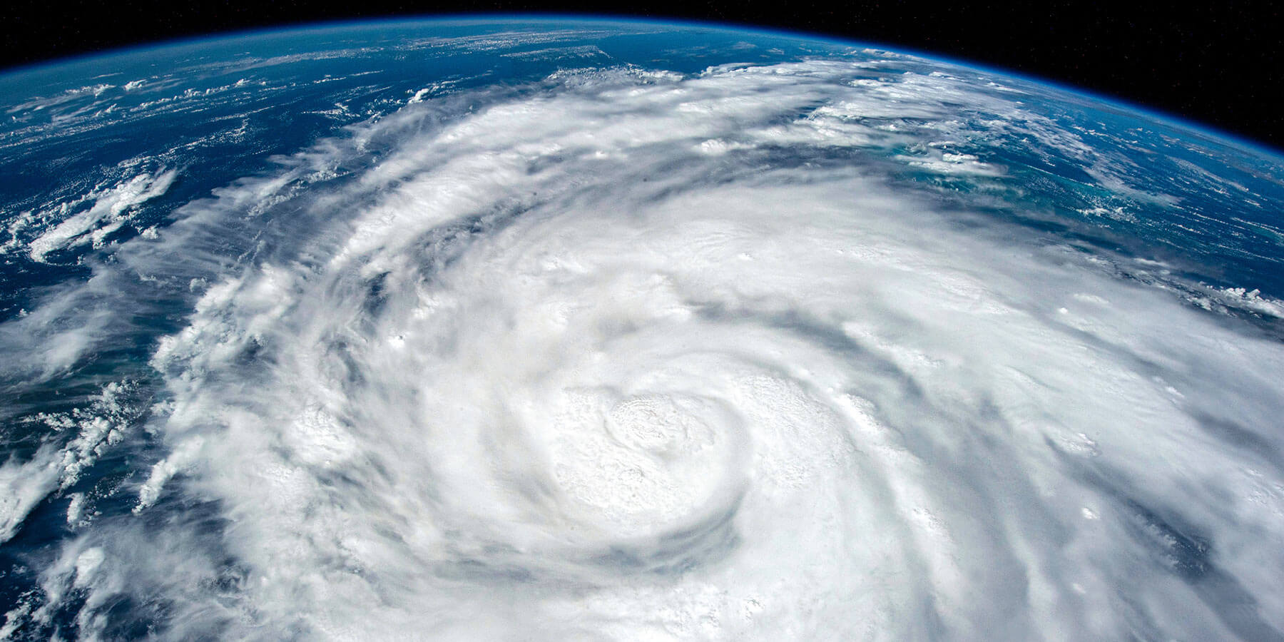
When a tropical storm like Jerry fully develops into a hurricane, its physical structure offers clues about its intensity and potential impact. The eye, a calm center surrounded by an eyewall of intense thunderstorms, is a hallmark feature of hurricanes.
The eyewall’s character, whether tightly compact or broader in diameter, directly correlates with storm intensity, as smaller, well-defined eyes often indicate stronger winds and lower central pressures. Rain bands spiraling outward distribute rainfall unevenly, increasing the complexity of localized impacts such as flash flooding or sudden wind gusts.
Storm size, however, can be misleading. Larger storm systems may distribute energy over a wider area but often lack the concentrated punch of their smaller counterparts.
Get Prepared for Tropical Storm Jerry/Hurricane Jerry
With Tropical Storm Jerry now under monitoring in 2025, it’s crucial to focus on preparedness. Understanding evacuation routes, stocking up on basic supplies, and keeping communication devices charged and ready are simple yet effective ways to stay ahead of the storm.
Individuals should also secure outdoor items, review their emergency plans with family members, and keep important documents stored in a waterproof container. Taking these small steps early can make a significant difference if conditions begin to deteriorate.
To prepare long-term, communities in storm-prone regions should work toward improving resilience through updated building codes, better flood management systems, and expanded public awareness campaigns. Investing in preparedness not only reduces risk but also speeds recovery after a storm passes.
For those looking to take action now, our Hurricane Resource Center offers free checklists, planning guides, and educational materials designed to help both individuals and communities strengthen their readiness before the next storm takes shape.
Outlook for Jerry
Whether Tropical Storm Jerry follows historical patterns, deviates from the norm, or strengthens into Hurricane Jerry, staying informed and prepared is important to mitigating its risks.
For the latest updates on Jerry’s development, visit the National Hurricane Center’s official website or download their mobile app for live tracking data. Remember, preparation is always your best defense.

