Each year, the Atlantic hurricane season brings a new slate of storm names. In 2025, the seventh named storm is Gabrielle. Its inclusion on the list of potential tropical cyclones offers a chance to explore what that name might mean for the season ahead.
This article is your guide to 2025 Tropical Storm Gabrielle and, now Hurricane Gabrielle, covering the name’s history, its prior usage, storm statistics, current trends, and how communities can prepare.
The Origins and Legacy of the Name “Gabrielle”

The name Gabrielle is part of the rotating six-year naming list curated by the World Meteorological Organization (WMO). Names are reused every six years unless they are retired due to particularly destructive impacts, in which case they are replaced with a new name starting with the same letter and gender.
The name “Gabrielle” has appeared multiple times in the Atlantic:
- 1989: Reached hurricane strength as a Category 4, causing ocean swells along the U.S. East Coast.
- 1995: Formed as a tropical storm and made landfall in Mexico, but never reached hurricane strength.
- 2001: Made landfall in Florida as a strong tropical storm, producing flooding and power outages.
- 2007: Formed near the Carolinas and caused localized coastal damage.
- 2013: Short-lived, with minimal land impact.
- 2019: A weak system that stayed out to sea and transitioned into a post-tropical cyclone.
And now, in 2025, with Tropical Storm Gabrielle having rapidly intensified into Hurricane Gabrielle. None of Gabrielle’s previous storms resulted in catastrophic losses. That’s why the name remains in rotation and is scheduled for 2025.
When Will Tropical Storm/Hurricane Gabrielle Arrive?

Gabrielle is the seventh named storm on the 2025 Atlantic list. Historically, the seventh named storm tends to form right around the peak of hurricane season. Based on a 30-year climatological average from NOAA’s HURDAT2 database, the seventh storm typically develops by September 2. That puts it squarely in early September, when conditions in the Atlantic are most favorable for tropical development.
To arrive at these dates, we pulled official storm formation data from NOAA’s Atlantic hurricane archive, which logs the exact dates when each tropical system first reaches named storm status. By calculating the average formation date of each numbered storm across three decades, the pattern becomes clear:
- 6th named storm: Around August 23
- 7th named storm: Around September 2
- 8th named storm: Around September 10
- 9th named storm: Around September 18
These averages match up closely with broader NOAA climatology, which identifies early to mid-September as the most active stretch of the Atlantic hurricane season. It’s no coincidence that the climatological peak, September 10, falls right between the typical formation dates of the 8th and 9th storms.
Why does this happen? Because storms forming during this period tend to encounter the warmest sea surface temperatures and lowest wind shear, ideal ingredients for rapid intensification. In fact, many of the most damaging hurricanes in modern history, including Maria (2017), Irma (2017), and Dorian (2019), formed or peaked in early September.
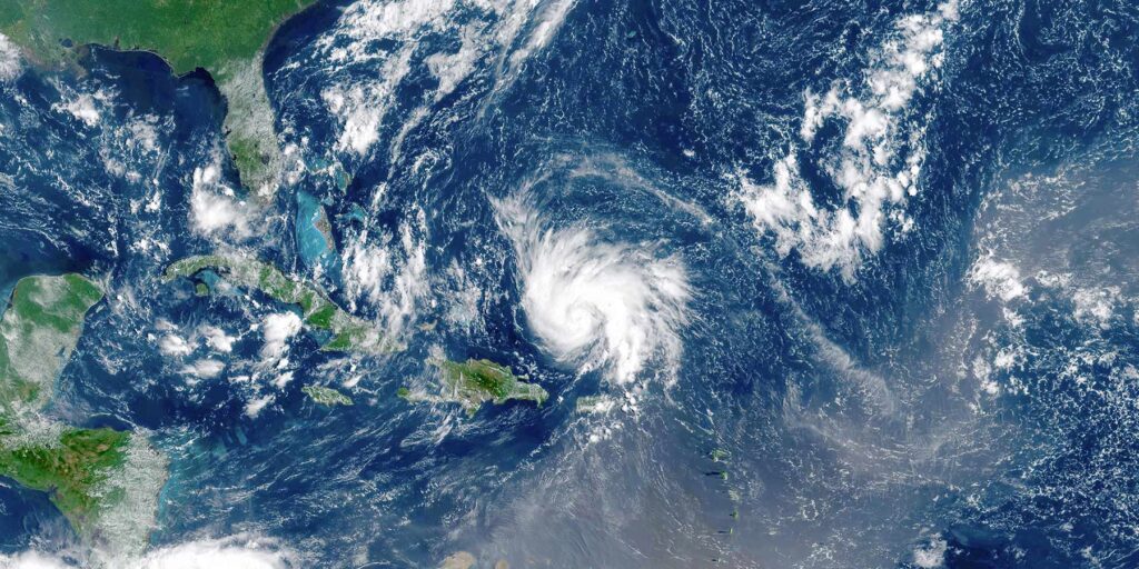
Tropical Storm Gabrielle formed on September 17, 2025, and rapidly intensified into Hurricane Gabrielle on September 22, 2025.
Observing Trends With G-Named Storms
While alphabetical storm position isn’t deterministic, a look at storms with a ‘G” name over the last few years reveals a trend worth watching.
Notable G-named Storms Since 2017:
- Gert (2017) – Stayed out to sea but became a hurricane.
- Gordon (2018) – Tropical storm that impacted the Gulf Coast.
- Gonzalo (2020) – Formed early but dissipated quickly.
- Grace (2021) – Reached Category 3 and caused major damage in Mexico.
- Gaston (2022) – Weak and stayed in the Atlantic.
- Gert (2023) – Became a short-lived hurricane.
- Gordon (2024) – Tropical storm that formed in the Gulf Coast, bringing heavy rain and flooding to parts of the southeastern U.S. before dissipating.
While some G-named storms have been weak or short-lived, the average intensity has increased. According to NOAA and peer-reviewed studies, rapid intensification, defined as an increase in wind speed of 35 mph or more within 24 hours, is occurring more frequently, particularly for storms forming during the peak season.
Looking Back at 2024
The 2024 ‘G’ storm, Gordon, provides some useful perspective. Gordon formed off the southeastern U.S. coast in early September and brushed past Bermuda as a Category 1 hurricane. It didn’t make landfall but did generate high surf and rip currents up the Eastern Seaboard.
Gordon didn’t cause major destruction, however, it showed how G-named storms can build quickly and threaten populated coastlines, even without a direct hit.
How to Prepare for Tropical Storm Gabrielle/Hurricane Gabrielle
No one can control where Gabrielle will go or how strong it might become. But preparation is entirely within reach. Here are some steps to reduce risk:
- Review Your Evacuation Zone
Many people are unaware of whether they’re in a surge-prone area. - Build a Custom Emergency Kit
Include prescriptions, pet supplies, chargers, and backup batteries. - Update Insurance
Check your coverage, especially for flood insurance through the NFIP. - Document Property
Use photos and video now—before any damage—to streamline claims. - Stay Informed
Monitor NOAA updates, and consider apps that send push alerts for watches and warnings.
Standing Ready Before, During, and After the Storm
When a storm like Gabrielle emerges, response and recovery efforts ramp up fast. That’s where Tidal Basin Group comes in. From advance planning and mitigation strategy to debris monitoring and FEMA reimbursement documentation, our team operates at every phase of a disaster cycle.
We prepare our clients for storms like Gabrielle before they ever appear on the radar. Contact us today to discuss how we can support your community before, during, and after the storm.
Curious about the rest of this year’s storm names? Take a look at our full breakdown of the 2025 Atlantic hurricane name list and what each name could signal for the season ahead.
Want to understand how forecasters predict where storms like Gabrielle might go? Check out our explainer on spaghetti models – the tools meteorologists use to visualize possible storm paths in real time.
Both resources offer deeper context on the season’s risks and tools you can use to stay informed.
FAQs About Tropical Storm/Hurricane Gabrielle
How are storms named?
The WMO assigns names on a six-year rotation unless retired due to significant destruction.
What is the difference between a tropical storm and a hurricane?
A tropical storm has winds between 39-73 mph, while a hurricane’s winds exceed 74 mph.
How many storms are typically named during a season?
On average, 12 to 14 storms receive names during a standard Atlantic hurricane season. This year, NOAA predicts 13-19 named storms.
Has a G-named storm been retired in the past?
Yes, names like Gilbert (1988) and Georges (1998) were retired after causing widespread destruction.
Does Gabrielle have a history of being destructive?
No, previous iterations of Tropical Storm and Hurricane Gabrielle have been moderate, but storm behavior can be unpredictable.
What areas could Gabrielle impact?
Its impacts will depend on formation and trajectory, but historical patterns suggest potential risks for the southeastern U.S. and Caribbean. As of now, 2025 Tropical Storm Gabrielle and it’s strengthening into Hurricane Gabrielle are predicted to stay out in the Atlantic Ocean.
What are the main factors influencing Gabrielle’s intensity?
Warm sea surface temperatures and low wind shear are key factors for storm development.
How early can I start preparing?
Hurricane preparedness should begin before the official season starts on June 1.
What apps are useful for storm tracking?
Apps like NOAA Weather Radar & Alerts, AccuWeather, and Windy are reliable.
Where can I learn more about hurricane preparedness?
Visit our Hurricane Resource Center for expert guidance and free community tools.


