As we prepare for Tropical Storm and Hurricane Erin in the 2025 Atlantic hurricane season, few realize the fascinating story behind this seemingly simple name. Tropical Storm Erin/Hurricane Erin carries a legacy that spans decades of meteorological history and cultural significance.
The 2025 Atlantic hurricane season is forecast to be above normal, with NOAA predicting 13-19 named storms, making the formation of Tropical Storm Erin (now Hurricane Erin) the 5th named storm of this season.
But understanding Erin means looking beyond weather forecasts to explore the interesting facts of hurricanes and tropical storms that have carried this name before.
Why the Fifth Storm Position Makes Hurricane Erin Statistically Significant
Historically, the fifth named storm of the Atlantic hurricane season, in this case, “Erin,” typically forms in late July to early August, coinciding with the season’s transition into its most active period.
Statistical analysis shows that approximately 70% of seasons produce at least five named storms, making Tropical Storm/Hurricane Erin a relatively common occurrence during normal to active seasons.
However, the timing of the fifth storm is an indicator of seasonal intensity. When the fifth storm forms earlier than the historical average of August 7th, it often signals an exceptionally active season ahead. The storm’s position is also a mathematical progression of tropical cyclone formation.
During peak season months (August through October), atmospheric conditions become increasingly favorable for storm development, with sea surface temperatures (SSTs) reaching their warmest levels and wind shear patterns typically at their most conducive for tropical cyclone formation.
The fifth storm position also places Erin within what meteorologists call the “heart of hurricane season,” when the majority of major hurricanes typically develop.
Historical data shows that storms forming in positions 4 to 8 on the naming list have a higher probability of reaching hurricane strength compared to earlier or later seasonal storms, making the potential Hurricane Erin worthy of particular attention from forecasters and coastal communities.
The Evolution of Hurricane Naming
Understanding why storms receive names like Erin requires examining the evolution of tropical cyclone nomenclature. The practice of naming storms (tropical cyclones) began years ago in order to help in the quick identification of storms in warning messages because names are presumed to be far easier to remember than numbers and technical terms.
Before systematic naming began, meteorologists used various methods to identify storms, including latitude-longitude coordinates, phonetic alphabets, and even saints’ feast days. The confusion this created, particularly when multiple storms threatened simultaneously, led to the adoption of the current system.
The hurricane naming convention was established in 1950, initially using only female names before expanding to alternate between male and female names in 1979. Tropical storms in the Atlantic region were originally named by the National Hurricane Center. Now, the World Meteorological Organization (WMO) chooses names from a rotating set of six lists.
The Legacy of Storms Named Erin

The name Erin has been used for six Atlantic storms between 1989 and 2019. While most were modest in strength, a few stood out for how unpredictable or persistent they were.
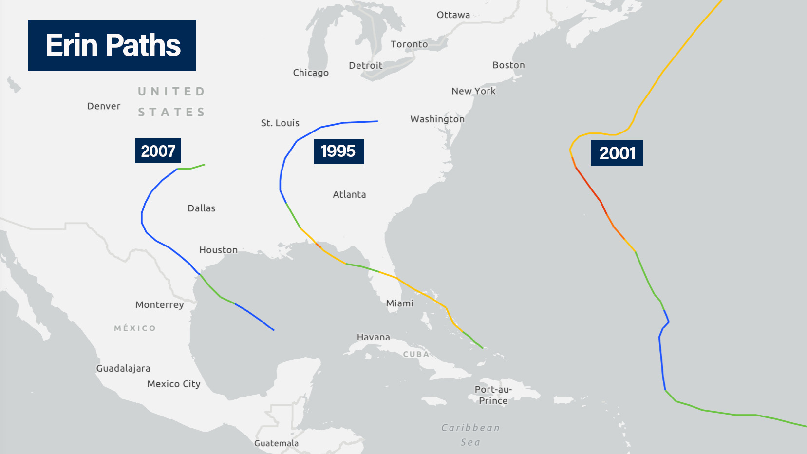
The most impactful was Hurricane Erin in 1995. It was the first hurricane to hit the U.S. mainland after Andrew in 1992, striking Florida twice as a Category 2 storm. It caused six direct fatalities and around $700 million in damage. Its double landfall was a reminder that a single storm can bring more than one round of trouble.
In 2001, Hurricane Erin became the longest-lived hurricane of that season, holding together far longer than most. And in 2007, a weak tropical storm version of Erin made landfall in Texas, but then did something rare: it restrengthened over Oklahoma, bringing damaging winds and flooding hundreds of miles inland.
These storms didn’t follow the typical script. That’s part of why the name Erin keeps showing up in discussions about storms that do something unexpected.
The Science Behind Storm Intensification and Behavior
Our understanding of tropical storms has come a long way since the first storm named Erin appeared on the charts. Most Atlantic hurricanes begin as tropical waves off the west coast of Africa. As they move across the ocean, they encounter conditions that can either help them grow or shut them down.
Warm ocean water is a key ingredient. Storms need SSTs of at least 80°F (26.5°C) to form, and deeper layers of warm water can drive rapid intensification. That kind of fast strengthening has become more common in recent years, often catching forecasters and communities off guard.
Wind shear, the variation in wind speed and direction at different altitudes, also plays a major role. Low wind shear helps storms stay vertically aligned, which is essential for growth. High wind shear, on the other hand, can tear storms apart before they get going.
Every storm named Erin has moved through a different mix of these conditions, leading to widely varying outcomes.
Climate Patterns and Seasonal Forecasting
Seasonal hurricane forecasts are based on big-picture climate patterns that influence how active a season will be. Two of the most important are El Niño and La Niña. El Niño tends to increase wind shear over the Atlantic, which can limit storm formation. La Niña does the opposite, often creating conditions that support more storms.
Other key factors include SSTs, moisture in the atmosphere, and storm activity off the west coast of Africa. Longer-term cycles, like the Atlantic Multidecadal Oscillation, can also tip the balance toward more or fewer storms in a given era.
These patterns help explain why some years see a storm named Erin, and others don’t. During active years like 1995 or 2005, the storm list gets deeper into the alphabet, making it more likely that the name Erin was used.
While these climate signals help forecasters estimate how busy a season might be, they can’t predict exactly when or where a storm will form. For that, meteorologists still rely on week-by-week monitoring and real-time data.
The Cultural Impact of Hurricane Names
Some hurricane names leave a lasting mark. Names like Katrina, Andrew, and Sandy carry strong emotional weight because of the destruction they caused. When a storm causes major damage or loss of life, its name is usually retired.
The name Erin has never been retired, despite being used several times. That suggests those storms, while still significant, didn’t cross the threshold of damage that prompts for removal.
It also shows how unpredictable hurricanes can be. Even with the same name, no two storms behave the same.
Technological Advances in Hurricane Monitoring

Our ability to monitor hurricanes has advanced dramatically over the past few decades. As of 2025, NOAA’s newest satellite, GOES-19, is live and it’s a major leap forward. It’s part of the GOES-R Series and offers higher resolution, faster scans, and better data than anything before it.
GOES-19 captures images every 30 seconds and uses 16 channels to analyze storm structure, cloud development, and temperature. Its core tool, the Advanced Baseline Imager, gives forecasters sharper insights into how a storm is evolving, especially when it’s gaining strength quickly.
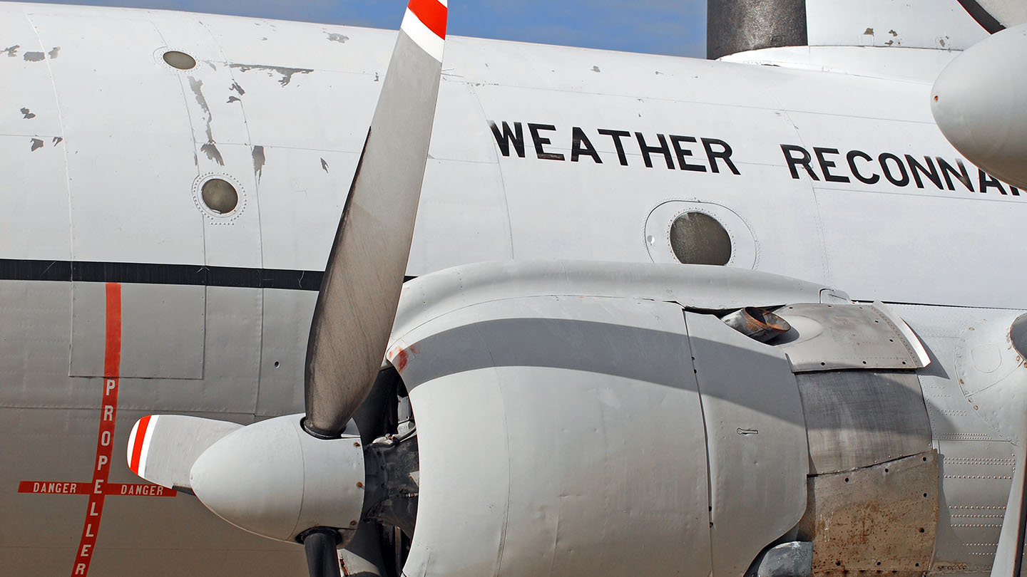
These satellite systems work alongside Hurricane Hunter aircraft, which still play a critical role. Flying directly into storms, they gather real-time wind and pressure data that help make forecasts more accurate.
The combination of satellites, aircraft, and ground observations gives us a full picture of how storms like Hurricane Erin behave, allowing for faster warnings, better predictions, and ultimately, stronger community preparedness.
Preparing for Future Storms Named Erin
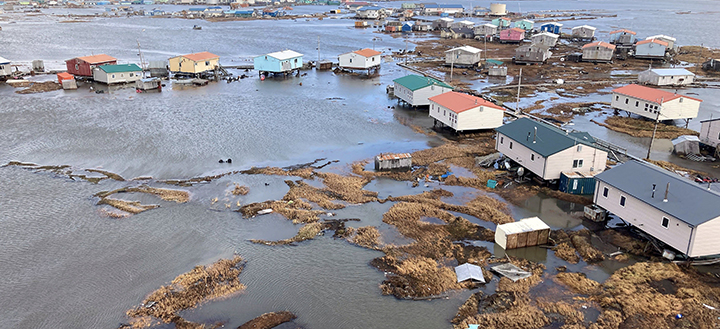
No matter what a storm is called, the basics of preparation don’t change. Tropical Storm Erin or Hurricane Erin could bring storm surge, high winds, and flash flooding just like any other system of similar strength.
Coastal areas that have experienced past storms named Erin (like Florida in 1995) know the importance of being ready. That storm hit twice, showing how one system can bring repeated impacts to the same area. Inland regions also need to stay alert, as seen with the remnants of 2007’s Erin unexpectedly strengthening over Oklahoma and causing severe weather far from the coast.
Today’s emergency planning emphasizes early decisions. Having a go-bag, knowing your evacuation route, and staying informed are key, no matter what name shows up in the forecast. Every storm is different, but the need to be prepared remains the same.
Frequently Asked Questions About Tropical Storm Erin and Hurricane Erin
How many times has the name Erin been used for Atlantic hurricanes?
The name Erin has been used for Atlantic tropical cyclones in 1989, 1995, 2001, 2007, 2013, 2019, and now the 2025 season. The name hasn’t been retired despite several past impactful storms.
Why do meteorologists give hurricanes human names instead of numbers?
Names are easier to remember than numbers and technical terms, making communication clearer during emergencies. Names also help media coverage and increase public awareness and preparedness for approaching storms
How often does the name Erin appear on the Atlantic hurricane list?
Erin appears as the fifth name on the Atlantic hurricane list, which rotates every six years. This means Erin is scheduled to be used again in 2031, 2037, and so forth, unless the name is retired.
What was the most destructive Hurricane Erin in history?
Hurricane Erin of 1995 caused the most damage, making two landfalls in Florida and resulting in $700 million in damages and six direct fatalities. It was the first hurricane to strike the continental United States since Hurricane Andrew in 1992.
Can tropical storms strengthen after moving inland like Erin did in 2007?
Yes, though it’s uncommon. Tropical Storm Erin in 2007 unexpectedly restrengthened over Oklahoma after making landfall in Texas, demonstrating that inland strengthening can occur under specific atmospheric conditions.
Who decides hurricane names and when they are chosen?
The World Meteorological Organization (WMO) maintains rotating lists of names chosen years in advance. Names are assigned by the National Hurricane Center when tropical storms develop sustained winds of 39 mph or higher.
What makes a hurricane name eligible for retirement?
Names are typically retired when storms cause significant death or destruction, making the name inappropriate for future use due to sensitivity concerns. The World Meteorological Organization (WMO) makes these decisions based on impact assessments.
Stay Prepared for the 2025 Atlantic Hurricane Season
Forecasters expect the 2025 Atlantic hurricane season to be more active than usual, increasing the chances that Hurricane Erin isn’t the last named storm we see. Whether you live along the coast or farther inland, now is the time to make sure your community is ready.
Want to get a better sense of what this season could bring? Our full guide to the 2025 Atlantic Hurricane Season covers each named storm, key climate patterns, and why this year stands out. Knowing what to expect is the first step toward being prepared.
Reach out today to schedule a consultation and make sure you’re ready for whatever this season has in store.


