During the 2017 Atlantic hurricane season, Hurricane Maria became a powerful Category 5 storm, leaving destruction across the Caribbean.
It stands as the third costliest hurricane in U.S. history, with the most severe impacts in Dominica and Puerto Rico. This overview highlights Hurricane Maria in 2017, including its formation, path, and lasting effects.
Here’s a quick look at Hurricane Maria’s main information:
- When: September 16 to 30, 2017
- Where: Caribbean, major impacts on Dominica and Puerto Rico
- Category: Peaked at Category 5 with about 172 mph winds (150 knots)
- Land Impacts: Extensive damage to homes, infrastructure, power grids, and agriculture, leading to a significant humanitarian crisis
The Formation, Path, and Intensification of Hurricane Maria
Hurricane Maria began as a tropical wave off the west coast of Africa on September 12, 2017. As it moved west across the Atlantic, the system gradually organized.
By September 16, it became a tropical depression and was upgraded to Tropical Storm Maria later that day, reaching hurricane strength on September 17.
Hurricane Maria’s Dates and Landfalls
- September 19, 2017: Landfall on Dominica as Category 5 with winds of 166 mph (145 knots)
- September 20, 2017: Landfall near Yabucoa, Puerto Rico as Category 4 with winds of 155 mph (135 knots)
- September 21 to 22, 2017: Passed near the Turks and Caicos Islands as Category 4
- September 27, 2017: Moved offshore of North Carolina as Category 1 storm and began to weaken
- September 30, 2017: Transitioned into an extratropical cyclone
The storm’s track through the Lesser Antilles, combined with its rapid strengthening, created extreme conditions across multiple islands, including Puerto Rico and Dominica.
Tracking the Path of Hurricane Maria
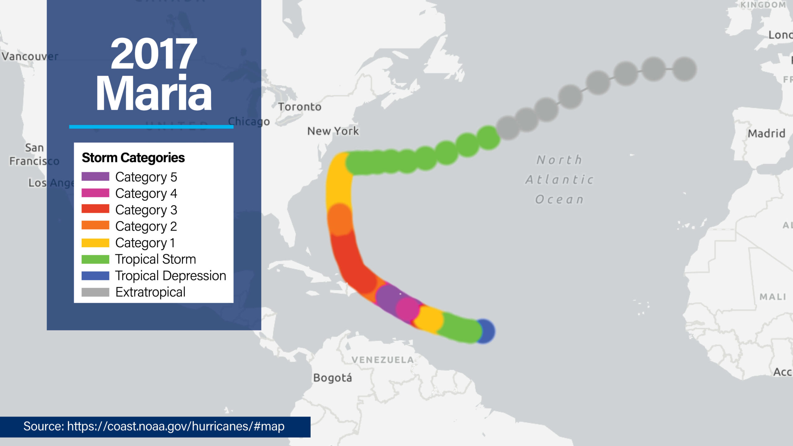
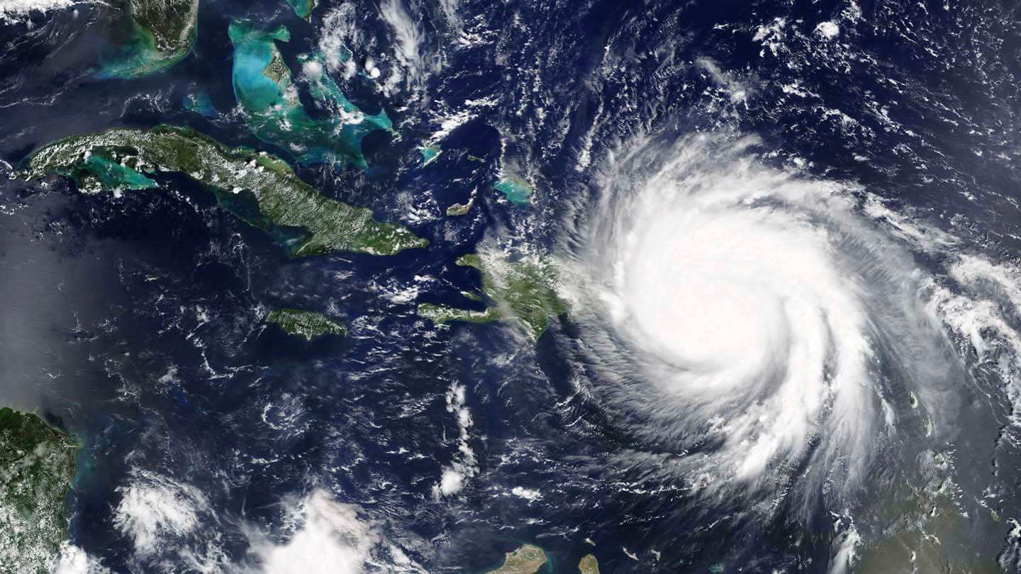
Hurricane Maria followed a destructive path across the Caribbean, impacting several islands before moving into the open Atlantic.
After forming off Africa and rapidly intensifying, Maria first struck Dominica on September 19 as a Category 5 hurricane. It then moved over the Caribbean Sea and hit Puerto Rico on September 20 as a strong Category 4 storm.
From Puerto Rico, the storm continued northwest, affecting the Dominican Republic and the Turks and Caicos Islands before turning north and moving offshore of North Carolina. During this trajectory, the hurricane’s large size and prolonged wind field exposed a wide area to extreme conditions, including sustained hurricane-force winds, heavy rainfall, and significant storm surge.
Satellite observations during this period documented Maria’s immense size and intensity, providing critical data for forecasting and disaster response.
Why Hurricane Maria Was So Devastating
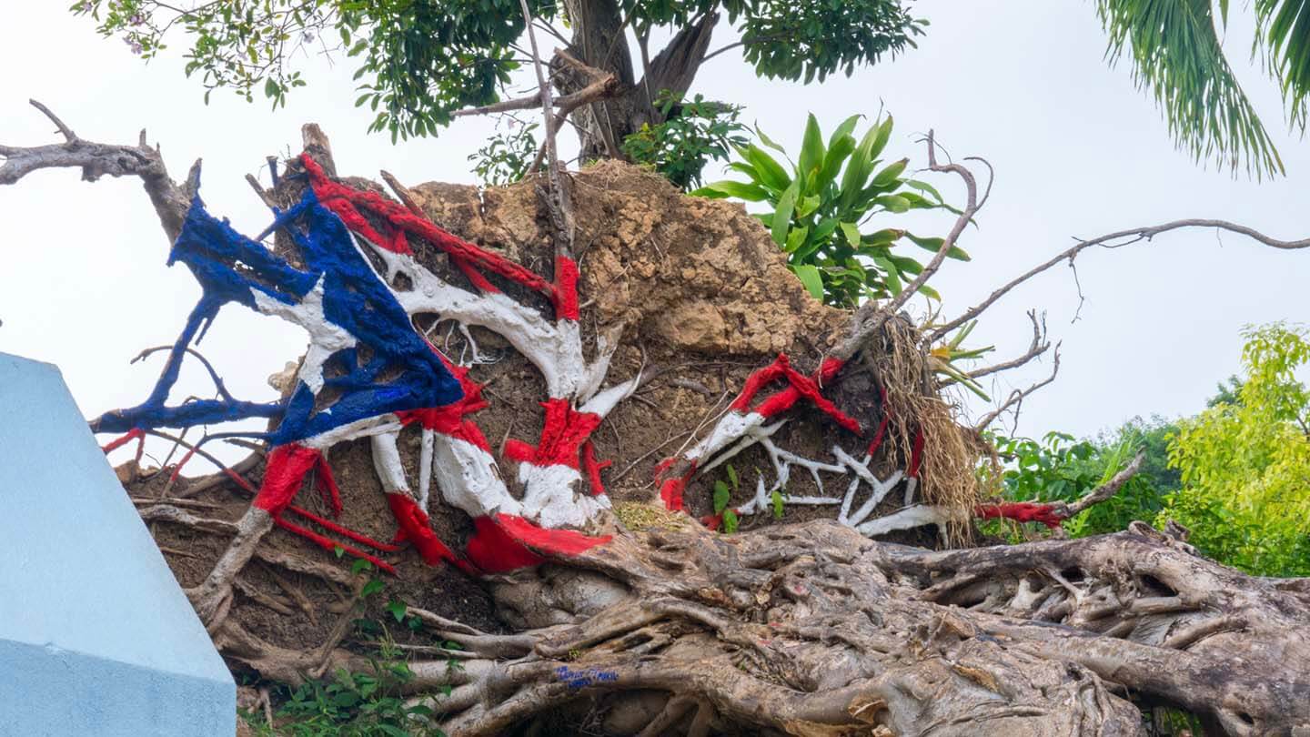
Hurricane Maria left widespread destruction across the Caribbean in September 2017, with the heaviest impacts in Dominica and Puerto Rico.
The storm also caused significant damage in Guadeloupe, Martinique, the U.S. Virgin Islands, and the Dominican Republic. Its combination of extreme winds, torrential rainfall, and storm surge created a severe humanitarian crisis.
Several factors made Hurricane Maria especially destructive:
- Intensity of Maria at Landfall
The storm hit Dominica and Puerto Rico with extreme force, producing overwhelming winds and storm surge. - Puerto Rico’s Electrical Grid Damage
Puerto Rico’s electrical grid, already stressed by Hurricane Irma two weeks earlier, could not withstand the direct hit. - Prolonged Impact Across the Islands
Maria’s large size and slow movement over the islands caused prolonged hurricane-force winds and heavy rainfall, leading to failures of power, water, and communications systems.
Impact on Dominica
Maria made landfall on Dominica on September 18, 2017, as a Category 5 hurricane with winds of 160 mph (139 knots). The storm’s force was catastrophic.
Most buildings lost their roofs, and most structures were either severely damaged or completely destroyed. Powerful winds stripped trees of vegetation, leaving the tropical landscape a field of debris. The island’s agricultural sector, a cornerstone of its economy, was effectively destroyed.
The storm caused 31 direct fatalities, with dozens more reported missing, and displaced a large portion of the population. Access to clean water, electricity, and other basic necessities was cut off for days.
Prime Minister Roosevelt Skerrit described the damage from Hurricane Maria as “mind-boggling,” when describing the disaster.
Impact on Puerto Rico
On September 20, 2017, the eye of Hurricane Maria made landfall in Puerto Rico as a high-end Category 4 storm with sustained winds of 155 mph (135 knots).
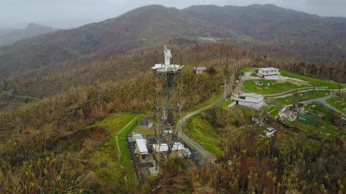
The storm knocked down 80% of Puerto Rico’s utility poles and transmission lines, creating the longest and largest power outage in modern U.S. history. For months, the majority of the island’s 3.4 million residents lived without electricity. Water systems failed, roads and bridges were washed away, and the WSR-88D radar, a critical meteorological tool, was destroyed.
The official death toll, based on a study by George Washington University’s Milken Institute School of Public Health, is 2,975, including direct deaths from the storm and indirect deaths caused by prolonged lack of electricity, clean water, and medical care.
Massive displacement, food and medicine shortages, and property destruction compounded the humanitarian crisis.
According to NOAA, overall damage from Hurricane Maria in Puerto Rico and the U.S. Virgin Islands was estimated at $90 billion, making Maria the third-costliest hurricane in U.S. history.
Meteorological Facts About Hurricane Maria
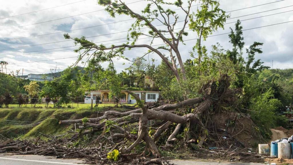
Hurricane Maria set multiple meteorological records. During its rapid intensification on September 18, the storm strengthened by 75 mph (65 knots) in 24 hours, ranking as the sixth-fastest intensifying hurricane in Atlantic basin history.
At peak intensity, Maria reached 172 mph (150 knots) with a central pressure of 908 mb. An outer eyewall replacement cycle expanded the eye diameter from 9 to 28 nautical miles, slightly weakening the storm but increasing the area exposed to destructive winds. Satellite observations documented the hurricane’s immense size and intensity.
Storm Surge and Coastal Inundation
Hurricane Maria generated significant storm surge across the affected islands. In Puerto Rico, maximum inundation levels reached 6 to 9 feet above ground near the southeastern municipalities of Humacao, Naguabo, and Ceiba.
Other areas experienced lower levels, with Vieques and St. Croix seeing 3 to 5 feet and Culebra, St. Thomas, and St. John experiencing 1 to 3 feet. Storm surge caused extensive damage to coastal infrastructure, including marinas, harbors, and homes.
Rainfall and Flooding
The storm produced torrential rainfall, with some locations in Puerto Rico receiving nearly 38 inches. Caguas recorded the highest total at 37.9 inches, while Dominica saw 22.8 inches. The combination of extreme rainfall and steep terrain caused flooding and landslides.
The La Plata River experienced catastrophic flooding, inundating communities in Toa Baja and requiring hundreds of residents to be rescued from rooftops. Other Caribbean islands, including Guadeloupe and the Dominican Republic, received 10 to 13 inches of rain, producing local flooding and mudslides.
Recovery and Future Preparedness
The aftermath of Hurricane Maria in Puerto Rico and Dominica revealed the immense challenges of disaster recovery and the critical need for stronger disaster readiness.
Destruction of homes, infrastructure, and essential services left residents displaced and emphasized the urgency of a quick response and recovery.
Tidal Basin’s Role in Recovery
Tidal Basin supported Puerto Rico’s recovery by partnering with the Puerto Rico Department of Housing (PRDOH) to manage the FEMA-funded Sheltering and Temporary Essential Power (STEP) program.
The initiative provided temporary repairs to tens of thousands of damaged homes, allowing residents to safely shelter in place while permanent repairs were conducted. The program also delivered temporary power solutions to homes to support residents during the blackout.
By helping families return to their homes more quickly and safely, Tidal Basin contributed to both immediate relief and the broader rebuilding of communities affected by Hurricane Maria’s damage.
Building Resilience After Hurricane Maria
Recovery from Hurricane Maria has shown the importance of stronger infrastructure and improved disaster readiness. Communities across Puerto Rico and other affected areas are rebuilding homes, restoring services, and applying lessons from the storm to reduce the impact of future hurricanes.
Tidal Basin continues to support these efforts through programs like the FEMA-funded STEP initiative. Contact our team to learn how we can help your community prepare, recover, and build resilience against future storms.
Frequently Asked Questions 2017 Hurricane Maria
What year was Hurricane Maria?
The strong, Category 5 Hurricane Maria occurred in the year 2017.
When did Hurricane Maria start and end?
Hurricane Maria was active from September 16 to September 30, 2017.
When was Hurricane Maria?
Hurricane Maria occurred in September 2017. It made landfall in Dominica on September 19, 2017, and in Puerto Rico on September 20, 2017. Its most destructive period was from September 18 to September 21 as it moved through the Caribbean islands.
What category was Hurricane Maria?
At its peak, Hurricane Maria reached Category 5 intensity with maximum sustained winds of 172 mph (150 knots).
Was Maria a Category 4 or 5 hurricane?
Hurricane Maria’s category at landfall varied as it struck Dominica as a Category 5 hurricane and Puerto Rico as a high-end Category 4 storm with 155 mph (135 knots) winds.
When did Hurricane Maria hit Puerto Rico?
Hurricane Maria struck Puerto Rico on the morning of September 20, 2017, when the eye of the storm came ashore near Yabucoa as a high-end Category 4 hurricane.
When was Hurricane Maria in Puerto Rico?
Hurricane Maria remained over Puerto Rico for most of September 20, 2017, with hurricane-force winds and heavy rain lasting into the evening before the storm moved back over open water.
Where exactly did Hurricane Maria hit?
The storm’s most severe impacts occurred in Dominica and Puerto Rico. Maria also caused considerable damage in Guadeloupe, the U.S. Virgin Islands (particularly St. Croix), and parts of the Dominican Republic.
What damage did Hurricane Maria cause?
Hurricane Maria caused extensive destruction, including the collapse of Puerto Rico’s electrical grid, severe structural damage, flooding, mudslides, and devastation to agriculture. Total economic losses in Puerto Rico and the U.S. Virgin Islands are estimated at $90 billion, according to NOAA.
What was the size of Hurricane Maria?
Before striking Puerto Rico, Maria’s eye expanded to approximately 28 miles in diameter during an eyewall replacement cycle, exposing a larger area to the strongest winds.
Has Puerto Rico recovered from Maria?
Recovery is ongoing. While substantial progress has been made in restoring homes and infrastructure, many communities continue to face long-term economic and social challenges from the storm, especially in remote or underserved areas.
How long did Hurricane Maria last?
Hurricane Maria maintained tropical cyclone status from September 16 to September 30, 2017. Its most destructive period occurred between September 18 and September 21 as it moved through the Caribbean.
