Tropical storms and hurricanes, including this year’s potential Tropical Storm Fernand or Hurricane Fernand, are among the most powerful forces in nature. As the 2025 Atlantic hurricane season progresses, people living in coastal and other high-risk areas should remain alert and make sure they are fully prepared.
Fernand is the sixth name designated for the 2025 Atlantic hurricane season, set to be assigned if a sixth storm reaches tropical storm strength, with the potential to intensify into Hurricane Fernand.
With Hurricane Erin now dissipated and Tropical Storm Fernand having formed and remained at sea, it’s still vital to explore what future systems could bring and how communities can stay ready.
While storms named Fernand in 2013 and 2019 remained tropical storms, studying their formation and impact helps refine preparedness for future systems.
Why is Fernand a Familiar Name?
Names for tropical systems like Fernand are chosen by the World Meteorological Organization (WMO) to streamline communication about significant storms.
So far, following the six-year rotating name cycle, Fernand has been used twice in the Atlantic basin. It has been used three times, including the 2025 Atlantic hurricane season.
Storm names are retired if the associated hurricane or storm is particularly devastating. Since previous Fernand storms weren’t especially destructive, the name remains in use and continues to be part of the rotating list.
Analyzing Previous Storms Named Fernand
Tropical Storm Fernand, 2013
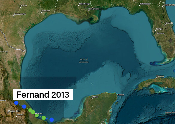
Tropical Storm Fernand emerged as a short-lived system in the Bay of Campeche. Within a day of forming, it made landfall near Veracruz, Mexico, unleashing heavy rainfall that caused flash flooding and landslides.
Additional stats for this storm:
- Rainfall totals reached 8.55 inches in Veracruz, with landslides leading to 14 fatalities.
- Damage extended across 19 municipalities, disrupting infrastructure and power for thousands.
The storm also brought peak winds of more than 55 mph (50 knots) and significant destruction to infrastructure, leaving a lasting impact on communities across Mexico.
Tropical Storm Fernand, 2019
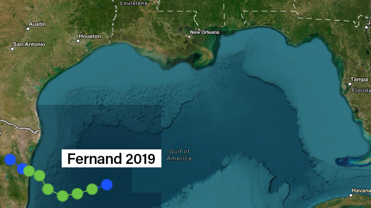
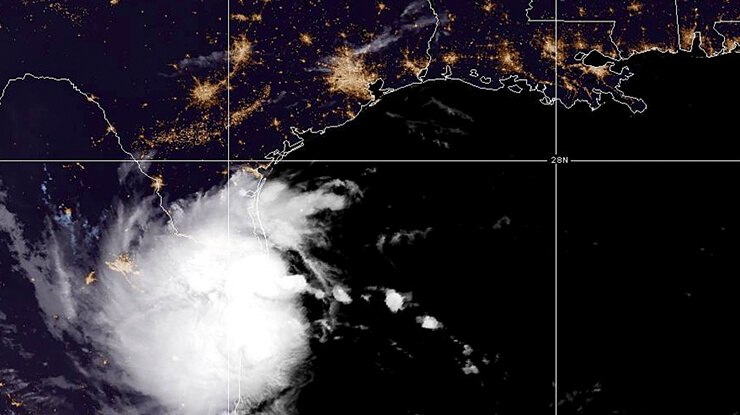
The 2019 iteration of Tropical Storm Fernand formed in the Gulf Coast and had a brief lifespan. It made landfall near La Pesca, Mexico, bringing torrential downpours and causing significant flooding, particularly in the state of Nuevo Leon.
Some details on this storm include:
- Rainfall exceeded 20 inches (529mm) in Monterrey, Mexico.
- The storm caused $383 million in damage in Nuevo Leon, primarily due to flooding.
Historical data shows that despite moderate wind shear, Fernand managed to achieve maximum sustained winds of over 50 mph (45 knots) before making landfall in northeastern Mexico.
Tips to Prepare for a Potential Hurricane Fernand
Preparedness is an essential part of minimizing loss and providing safety during tropical systems.
Here are actionable steps to safeguard your property and community:
- Stock up on emergency supplies like non-perishable foods, clean water, flashlights, batteries, and medical essentials.
- Secure your home by boarding up windows, reinforcing doors, and clearing drainage systems to help reduce flooding risks.
- Prepare for evacuation by learning local routes and keeping a go-bag with essentials like ID, cash, and medications.
- Stay updated by monitoring weather reports from reliable sources such as the National Hurricane Center or local meteorologists.
- Protect vital documents by storing insurance policies, property deeds, and other critical records in a waterproof container or digital backup.
Connect With Our Team for Hurricane Preparedness and Recovery
Whether you’re looking to safeguard your community, develop a continuity of operations plan, or better understand the evolving risks of hurricane season, our team is here to help.
We offer guidance, resources, and customized support for states, counties, cities, and organizations preparing for or recovering from storms like Fernand.
Reach out today to start building your preparedness strategy.
Explore More Named Storms
Curious about the full list of named storms from last year and this year? Stay informed and ready by reviewing the official lists:
FAQs About Fernand
Can a tropical storm turn into a hurricane?
Yes, storms can intensify into hurricanes under the right conditions, such as low wind shear and warm sea temperatures.
Can storms like Fernand cause significant damage?
Absolutely. Even short-duration storms can drop immense amounts of rain, leading to flash floods and landslides.
Why didn’t Tropical Storms Fernand in 2013 and 2019 intensify into hurricanes?
Both storms faced environmental variables, like increased wind shear, which limited their intensification potential despite initially favorable conditions.
Can storms like Fernand happen again in the same region?
Yes, the Gulf Coast is a hotspot for tropical storm formation due to its warm waters and the environmental conditions conducive to cyclone development.
What does it mean when a storm’s name is retired?
If a storm causes exceptional damage or loss of life, its name is retired to respect the affected communities’ experiences and to avoid future confusion. The name Fernand has not been retired because its associated storms, while impactful, weren’t deemed catastrophic by the WMO.
How can I monitor future hurricanes?
Resources like the National Hurricane Center provide up-to-date information during hurricane season. Pay attention to “spaghetti models” for storm trajectory projections.
What role does an IT disaster recovery plan play during hurricanes?
An IT disaster recovery plan ensures critical data, communication systems, and operations remain functional during and after significant weather events.
